Airport approaches

Videos below of flying approaches into airports. The goal is to provide context of the surrounding landscape for the benefit of other pilots planning to fly into these airports for their first time.

California

  1. Angwin Airport-Parrett Field, Angwin, CA (2O3) runway 34, November 3, 2018.
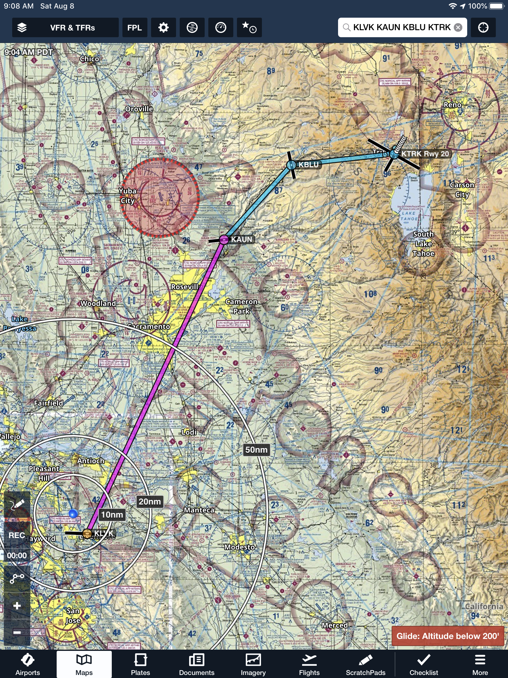
  2. Auburn Municipal Airport, Auburn, CA KAUN runway 25, Oct 21, 2018.
  3. Bakersfield Municipal Airport, Bakersfield, CA (L45), October 19, 2024
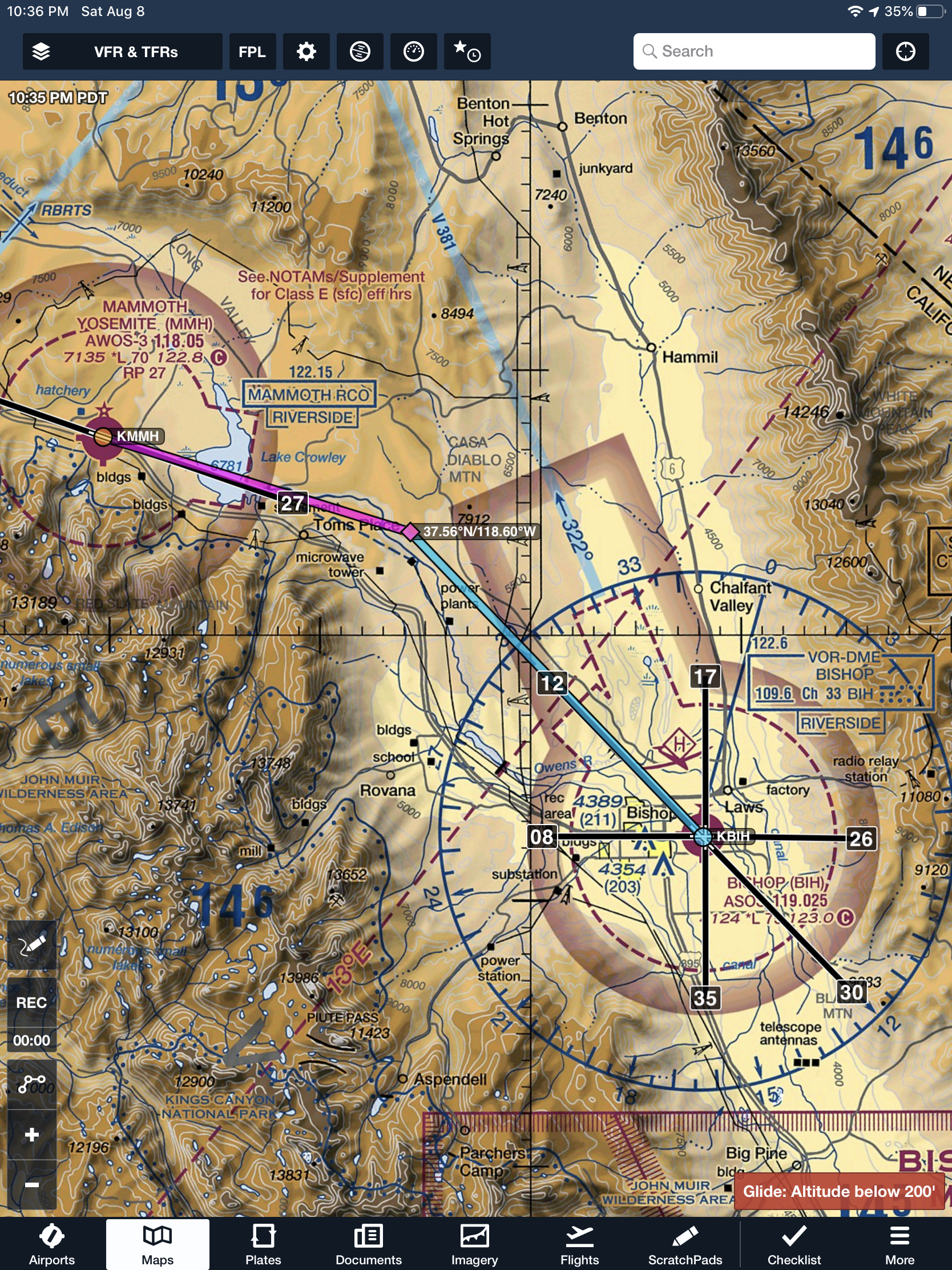
  4. Bishop Airport, Bishop, CA (KBIH) runway 12, August 9, 2020.
  5. Buchanan Field, Concord, CA (KCCR) runway 19L, September 9, 2024, runway 19R, September 9, 2024
  6. Calaveras County Airport – Mary Rasmussen Field, San Andreas, CA (KCPU) runway 31, June 26, 2020.
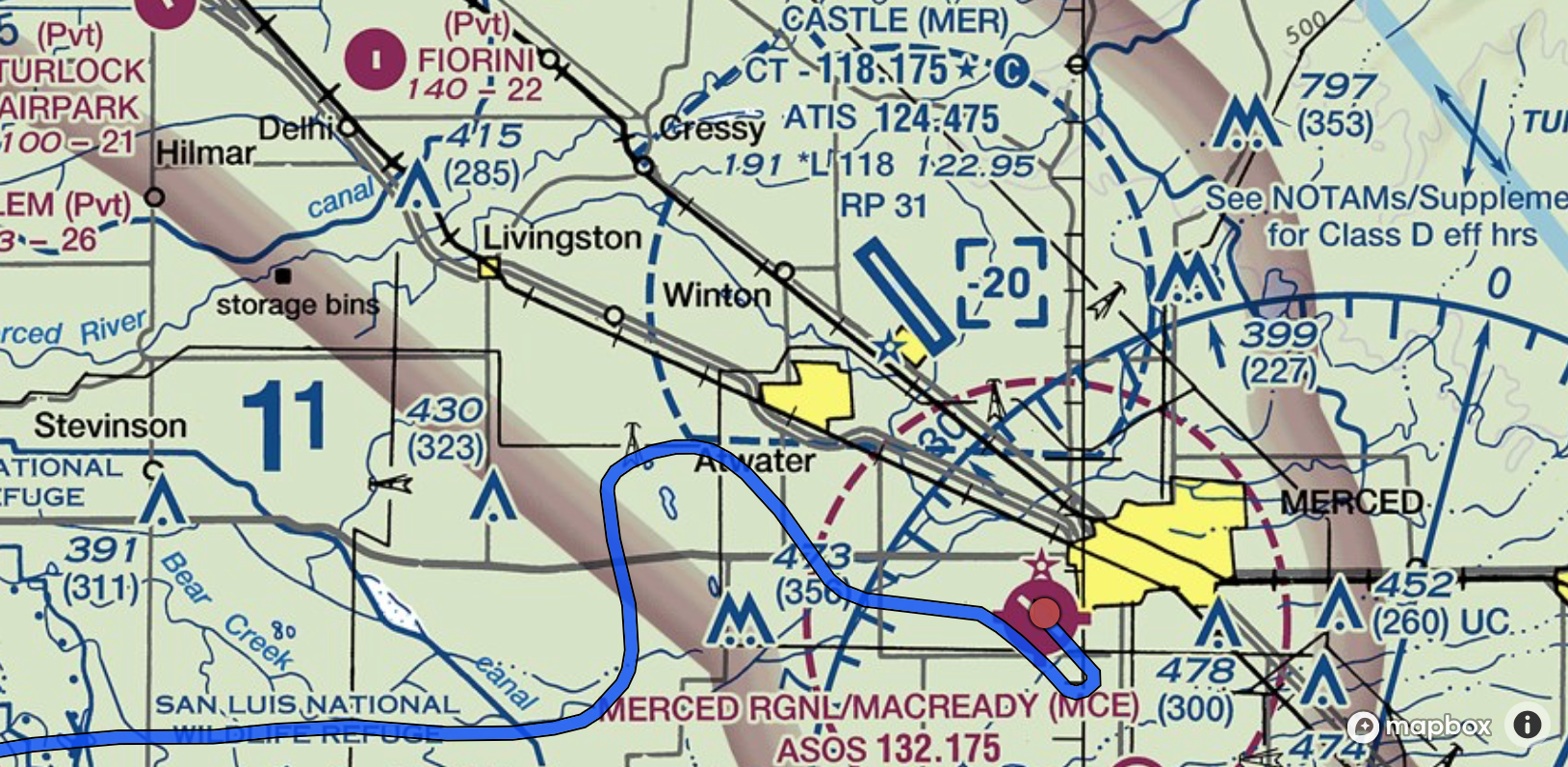
  7. Castle Airport, Atwater, CA (KMER) runway 31, June 8, 2018.
  8. Charles M Schulz – Sonoma County Airport, Santa Rosa, CA (KSTS) runway 14, July 14, 2019.
  9. Columbia Airport, Columbia, CA (O22) runway 17, June 8 2018
  10. Daugherty Field, Long Beach, CA (KLGB) runway 26L, October 19, 2024
  11. Firebaugh Airport, Firebaugh, CA, (F34) runway 30, March 26, 2019.
  12. Franklin Field Airport, Franklin, CA, (F72) runway 27, June 26, 2020.
  13. Half Moon Bay Airport, Half Moon Bay, CA
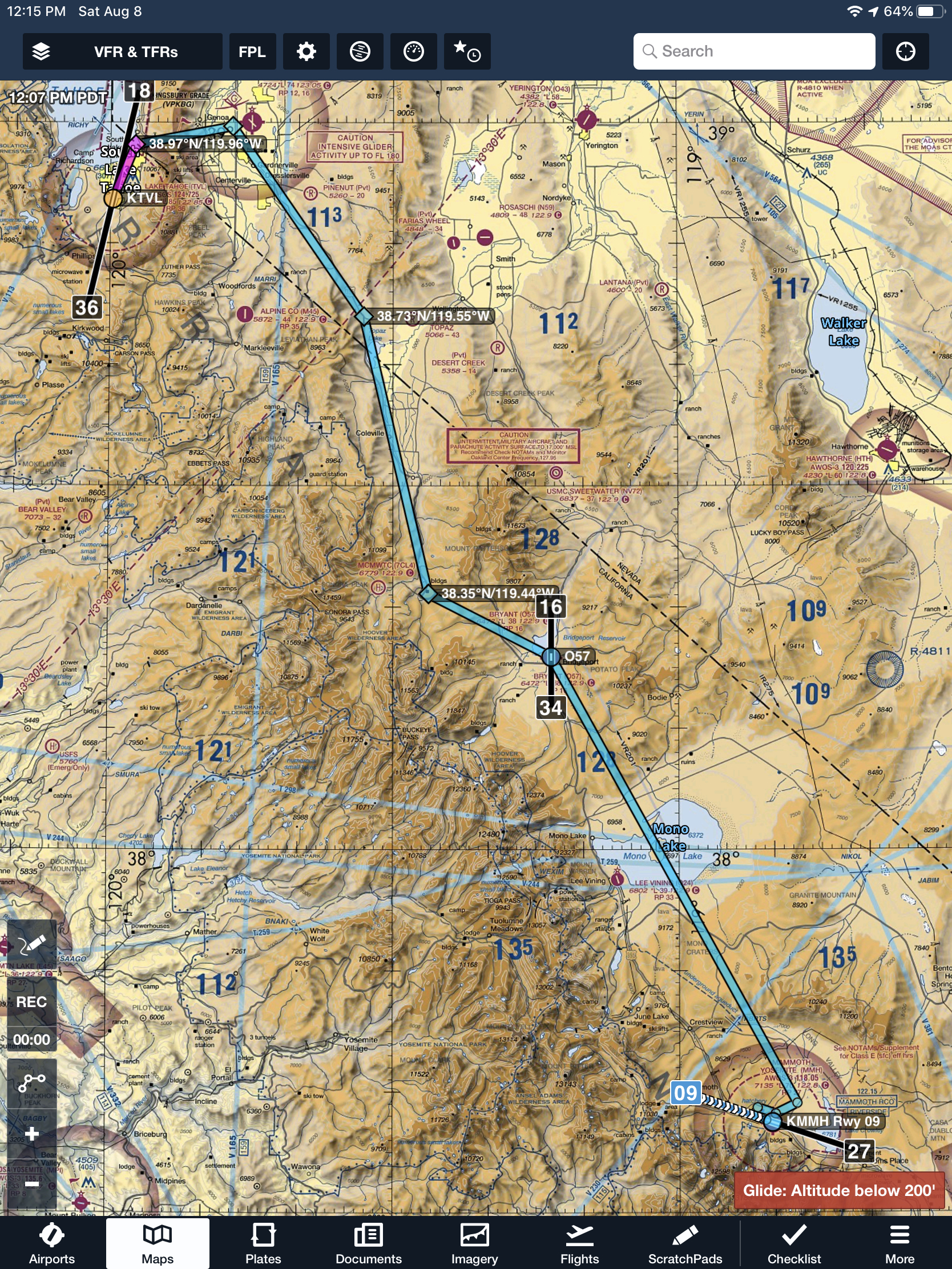
  14. Lake Tahoe Airport, South Lake Tahoe, CA (KTVL) runway 36, August 9, 2020, August 14, 2025.
  15. Lincoln Regional/Karl Harder Field, Lincoln, CA, (KLHM) runway 33, April 13, 2018, runway 33 on March 27, 2018, runway 15 on Apr 30, 2018.
  16. Livermore Municipal Airport, Livermore, CA (KLVK) runway 7L, January 19, 2019, runway 25L on April 7, 2019. Takeoff from runway 25R on Jun 26, 2020. LVK3 (ODP) obstacle departure procedure through IMC conditions on Aug 14, 2025.
  17. Lodi Airport , Lodi, CA (1O3) runway 26, July 2, 2019.
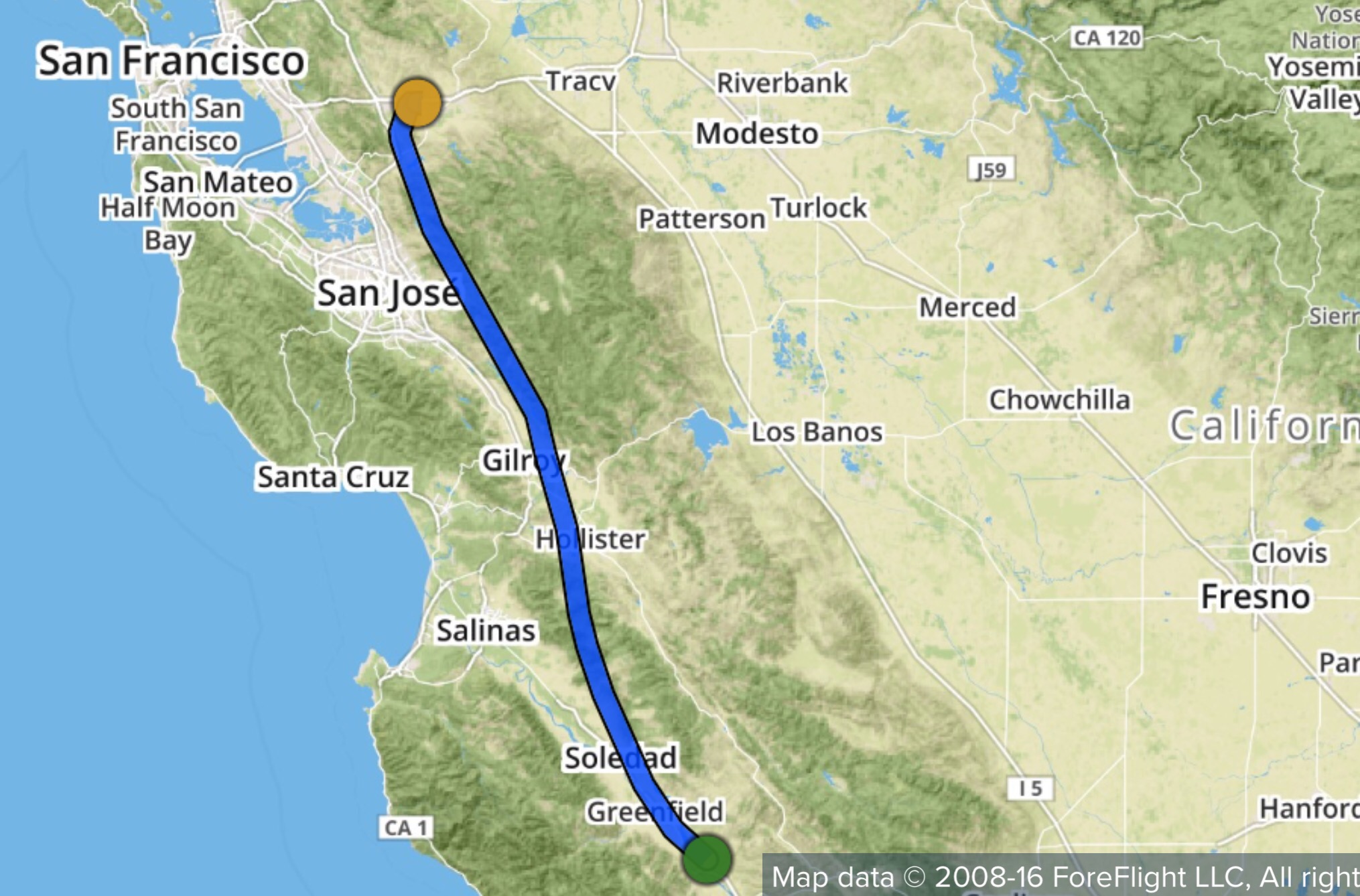
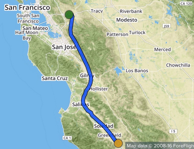
  18. Los Banos Municipal Airport (KLSN) RNAV GPS runway 14 approach, August 21, 2025.
  19. Madera Municipal, Madera, CA (KMAE) runway 30, June 23, 2017.
  20. Mammoth Yosemite Airport, Mammoth Lakes, CA (KMMH) runway 9, August 9, 2020.
  21. Mather
  22. McClellan Airfield, Sacramento, CA (KMCC) runway 16, August 20, 2019.
  23. Merced-Yosemite Regional Airport, Merced, CA (KMCE) ILS approach runway 30, takeoff runway 30, August 21, 2025.
  24. Mesa Del Rey, King City, CA (KKIC) runway 29, June 23, 2017.
  25. Modesto City–County Airport, Modesto, CA (KMOD) runway 28R, June 8, 2019. This used to be a commercial airport and the terminal is still intact but no longer actively used.
  26. Napa County Airport, Napa, CA (KAPC) runway 18L, July 14, 2019.
  27. Nervino Airport, Beckwourth, CA (O02) landing Runway 8, then departing Runway 8. August 14, 2025
  28. New Jerusalem, CA (1Q4) runway 30, Sep 22, 2017.
  29. Nut Tree, Vacaville, CA (KVCB) runway 02, March 11, 2018, runway 20 May 20, 2018.
  30. Oakdale Municipal Airport, Oakdale, CA O27 runway 28 June 8, 2019.
  31. Metropolitan Oakland International Airport, Oakland, CA (KOAK) runway 28R July 14, 2019.
  32. Palo Alto, CA KPAO runway 31, Aug 26, 2018.
  33. Paso Robles, CA KPRB runway 19, Sep 22, 2018.
  34. Petaluma Municipal Airport, Petaluma, CA (O69) runway 29, July 14, 2019.
  35. Rancho Murieta Airport, Rancho Murieta, CA, (KRIU) runway 22, Jun 20, 2020.
  36. Reid-Hillview Airport of Santa Clara County, San Jose, CA KRHV runway 31R, Aug 26, 2018.
  37. Rio Linda Airport, Rio Linda, CA (L36) runway 35, April 13, 2018. This runway is very narrow at 2,625′ x 42′, so is the taxiway. You’ll need to back taxi on part of the runway to reach the threshold of runway 35.
  38. Sacramento Executive Airport, Sacramento, CA KSAC runway 20 April 7, 2019.
  39. Sacramento Mather Airport, Sacramento, CA (KMHR) runway 22R, November 3, 2018. Runway 22R, March 18, 2023.
  40. San Luis Obispo, CA KSBP runway 29, May 27, 2018. Takeoff San Luis Obispo, CA KSBP runway 29, May 28, 2018.
  41. Santa Barbara Municipal Airport, Santa Barbara, CA KSBA runway 15R, April 7, 2022
  42. Santa Maria Public Airport Capt G Allan Hancock Field, Santa Maria, CA KSMX runway 30, April 7, 2022
  43. Santa Ynez Airport, Santa Ynez, CA KIZA runway 08, April 7, 2022
  44. Shafter-Minter Field, Bakersfield, CA KMIT runway 30, September 28, 2024
  45. Sierraville Dearwater Airport, Sierraville, CA (O79) landing runway 21, takeoff runway 21. August 14, 2025.
  46. Stockton Metropolitan Airport, Stockton, CA KSCK runway 29R, April 7, 2019.
  47. Tracy Municipal Airport, Tracy, CA (KTCY) runway 12, June 26, 2020.
  48. Truckee-Tahoe Airport, Truckee, CA (KTRK) landing runway 29, takeoff runway 29, August 14, 2025.
  49. Turlock Municipal Airport, Turlock, CA O15 runway 30, January 13, 2019.
  50. University Airport, Davis, CA (KEDU) runway 17, March 17, 2021
  51. Watsonville Municipal Airport, Watsonville, CA (KWVI) runway 20, December 31, 2020
  52. Watts-Woodland Airport, Woodland, CA O41 runway 36, March 19, 2019.
  53. Westover Field Amador County Airport, Jackson, CA (KJAQ) runway 19, Jun 26, 2020.
  54. Whiteman Airport, Pacoima, CA (KWHP) runway 12, September 28, 2024
  55. Yolo County Airport, Davis/Woodland/Winters, CA (KDWA) runway 16, March 17, 2021
  56. Yuba County Airport, Marysville, CA (KMYV) runway 32 and 14, March 18, 2023

Oregon

  1. Crater Lake-Klamath Regional Airport, Klamath Falls, OR KLMT runway 14, August 03, 2019.
  2. McNary Field Airport, Salem, OR KSLE runway 16, August 06, 2019.
  3. Rogue Valley International – Medford Airport, Medford, OR KMFR runway 32, August 06, 2019.

Washington

  1. Renton Municipal Airport, Renton, WA KRNT runway 34, August 03, 2019


Instrument Training

Class 1 – Jan 24, 2021

I had reviewed the ILS and VOR approach plates to KLVK and KSCK before I met my instructor. We reviewed a number of questions I had from the approach plates. Being our first instrument training flight, we spent the day primarily to determine power settings on the aircraft for (1) maintaining level 105kts cruise, (2) descending 500fpm at 105kts cruise, (2) approach speed of 90kts and (3) descending 500fpm at 90kts. All while I was under the hood, so it was good practice to manage airspeed and heading while maintaining descent rates or level cruise. It was a cloudy, rainy and windy day. I wasn’t sure if I’ll get actual instrument time but we managed not to have to file an instrument flight plan.

Here is a video of one tidbit I learned about the dates printed on an approach chart.

Is your instrument approach procedure chart current?

Class 2 – Feb 2, 2021

Today was forecast to be clear in the afternoon but it was quite cloudy until our departure time. Ceilings were high enough that we could fly VFR once again. On the other side of Altamont pass, huge cumulus clouds were billowing. We managed to skirt it on the south side to make it to Linden VOR. There, we practiced a couple of holds in a left pattern to get the hang of direct entry and parallel entries. On the parallel entry, after establishing in the holding pattern i.e., flying over the VOR and then counting off a minute, I incorrectly made a left turn instead of making a right turn. But I did vocalize that the required turn was well over 180 degrees and my instructor called out that I was turning in the wrong direction. It was hard to maintain situational awareness while juggling the heading and VOR radial for the inbound course.

ATC may give you abbreviated hold instructions based on a published procedure as follows: Cessna Two-Five-Echo-Sierra, hold northeast of ALTAM as published. Expect further clearance at 2215Z, current time 2200Z. ATC must always issue complete holding instructions when pilots request them. Or, they could provide an unpublished hold as follows: Piper Seven-Niner-Two-Tree, hold east of the Linden VOR on the 320-degree radial, 4-mile legs. Expect further clearance at 10 past the hour.

Cross the fix

Turn outbound

stay in the hold

AIM 5-3-3(a)(1)(f) and (g) states that the following reports should be made to ATC or FSS facilities without a specific ATC request: The time and altitude or flight level upon reaching a holding fix or point to which cleared and When leaving any assigned holding fix or point.

When holding at a VOR station, pilots should begin the turn to the outbound leg at the time of the first complete reversal of the to/from indicator.

Mountain Flying

Date: Sunday, August 9, 2020

Planned route: Livermore (KLVK) – Truckee Tahoe (KTRK) – Lake Tahoe (KTVL) – Mammoth Yosemite (KMMH) – Bishop (KBIH) – Livermore (KLVK)

Aircraft: Cessna 182

Preflight Planning

Leg 1 – KLVK – KTRK

Cruise altitude: 9,500′

Detailed route: Livermore, direct to overfly Auburn (KAUN), follow I-80 through Blue Canyon-Nyack (KBLU), over Donner pass (7088′) and Donner Lake into Truckee. Approach runway assignment per Truckee tower (operating 7am-8pm on this date). Per published noise abatement procedures on truckeetahoeairport.com, stay south of I-80 past Donner Lake, stay just north of residential area and head for airport. Right traffic runway 20 (calm wind), or left traffic runway 29.

Enroute: 1hr 10min

IMG_AFD5EEC3CB42-1.jpeg

Leg 2 – KTRK – KTVL

Cruise altitude: 9,500′

Detailed route: Depart Truckee towards west (per aforementioned noise abatement procedures), turn south over Gateway and follow Hwy 89 to Tahoe City on the lake, then along west shore to South Lake Tahoe airport. Preferred arrival runway 18, monitor CTAF. Refer noise abatement procedures at cityofslt.us.

Enroute: 25min

IMG_0155.PNG

Leg 3 – KTVL – KMMH

Cruise altitude: 9,500′

Detailed route: Depart Lake Tahoe along east shore, through Kingsbury grade (Daggett pass 7,344′ elevation) summit towards Minden. Then, follow I-395 through Bridgeport, Mono Lake to Mammoth.

Enroute: 1hr

IMG_2C3A700466A7-1.jpeg

Leg 4 – KMMH – KBIH

Cruise altitude: 9,500′.

Detailed route: Depart Mammoth, circling climb to 9,500′. Stay north of I-395 and once the terrain to the east of Lake Crowley is cleared, start descent into Bishop.

Enroute: 20min

IMG_D59461C1B72F-1.jpeg


Leg 5 – KBIH – KLVK

Cruise altitude: 12,500′ until Tenaya lake then gradual descent to cruise at 8,500′ 

Detailed route: Depart Bishop towards north, climb to at least 8,000 before turning west past Casa Diablo Mtn. Skirt north of Mammoth and head to Lee Vining  O24 targeting 12,500′ by then. Head west over Hwy 20 through Tioga pass and after Tenaya lake (35 mins), start slow descent and direct to KLVK.

Enroute: 1hr 33min

IMG_DFD38EC3B6F2-1

IMG_45D644FF9BD9-1.jpeg

PPL-ASEL Checkride

Last week I called my DPE as previously discussed and got a cross country from KLHM to KMRY for planning. Also, I got the weight and balance details which I worked out in advance. Otherwise, I was asked to prepare per the ACS.

I arrived at Lincoln last evening and stayed overnight. Lincoln airport charges a $5 transient parking fee for overnight tie down. You can pay at the self-service box on the ramp. You can get an Uber from the airport to one of the local hotels. I had tried calling the airport twice to find out the availability of courtesy cars but only reached their voicemail.

My checkride started this morning at 9am. I met the DPE at their hangar. DPE wanted to start off by understanding how I got into flying and what I expected to do with the license. Since I’m interested in volunteering, DPE suggested I go a step further and see if I could work with companies who need photographers/pilots (eg. Sierra Pacific, US Fish and Wildlife). A commercial license will be helpful in that case.

After a few minutes, we started by reviewing and signing my IACRA online, reviewing identification documents, knowledge test, pilot and medical certificates and the pilot logbook for all the necessary endorsements. Next, I was asked to show how the aircraft is ‘qualified’ for our flight today. I went through the annual for airframe, engine and propellor, reviewed the ADs that have been completed with our 50-hr inspections. We had a discussion around whether or not our planes need a 100-hr inspection considering our club is owner-operated. These planes are not considered ‘for-hire’ for flight training (because the instructors are paid directly and they are not employed by the club). DPE explained that especially for today’s checkride, since it is not flight training we don’t need a 100-hr inspection. We talked about always logging accidents and incidents with the NASA Aviation Safety Reporting System and the associated form at the back of FAR/AIM (on page 1127 in the 2018 edition).

The oral exam was a combination of scenario based and direct questions. DPE let me refer materials (I had all the handbooks and manuals on my iPad) whenever needed and occasionally even pointed out specific sections in documents to refer.

First scenario was that of a private pilot taking friends to Monterey who offer to pay for the trip. Upon landing at Monterey, FAA agent does a ramp check. We talked about this at length, including ADM, hazardous attitudes, PAVE checklist especially external pressures since friends are involved. We also discussed IMSAFE and personal minimums. It helped in the discussion that I had one already filled out. A variation on the scenario was that I had flight following but my radios died before entering Monterey class Charlie. What would I do next?

We looked at weight and balance for the aircraft. I was asked to explain how I know if it is still valid.

If placards have faded, is the aircraft still fit to fly?

We had a discussion around inoperative equipment. How do we know if fuel gauge isn’t working and would we fly with such a gauge? How about a failed attitude indicator? How should we deal with inop equipment? Then we went on to minimum equipment list, equipment list from the POH listing required equipment, A TOMATO FLAMES checklist.

Know the ADs for your aircraft, when they were complied with and in the case of recurring ADs the frequency at which to inspect.

Then we had a detailed discussion of the electrical system and fuel system. What if either the alternator or battery fails during flight. A related question was why the alternator generates 14V when the battery is only rated for 12V.

Next we reviewed the cross country plan and discussed the route, altitude choices, airspaces along the way, requirements for the airspaces, special use airspaces and their requirements, flying over water and class Bravo considerations. If the cross country was planned at night what I would do differently, do I need oxygen. Requirements for flying under class Charlie shelf and over class Delta. DPE liked the fact that I had the plan on Foreflight/iPad as well as a written cheat sheet with landmarks, headings and ETA.

We took a break before starting on the flight portion of the test. DPE said I can take all the time I needed to adequately set up for each maneuver. Flight following was at my discretion and if I chose then I should only ask for it until the maneuver area south of Sacramento.

Winds were really picking up outside so I could call for discontinuance if I was ever uncomfortable either before or during the checkride. DPE wanted to see one go-around during the course of the test. As expected, we’ll start the cross country but wouldn’t go beyond Sacramento and DPE wanted me to check the weather at all the local airports and point out the ones I wouldn’t be comfortable landing for a diversion. Mather and Auburn were at or above my 10 kts crosswind component limit and the rest were manageable.

We started with a soft field takeoff and I called up Norcal for flight following (just because I could) and started tracking heading for first checkpoint on the cross country plan to intercept a radial from SAC VOR. Then I turned towards the VOR for my second checkpoint when the DPE said passengers in the back seat were feeling airsick. So I changed destination to KSAC. We landed then taxied back for a soft field takeoff departing right 45 towards Folsom lake for maneuvers. First, I realized my window was open when I took off and tried to close it on upwind but the winds were blowing me around. Steve’s advice to “fly the plane” rang in my ears and I left the windows alone to stay with the climb out at 75-80 kts and stabilizing before trying again to close the window. Second, in the distraction I almost busted into Sacramento’s class Charlie. En route, I donned the hood for instrument work and two unusual attitudes.

Next we started with slow flight in the landing configuration. DPE asked me to start a shallow turn at 60 kts when I was still getting configured towards my usual flying slow flight at 50 kts. So I was a little bit caught off guard. We discussed this later in the debrief after checkride. Then I did power OFF stall in the landing configuration, power ON stall in the takeoff configuration, steep turns to the left then right. From there we proceeded to Lincoln for some landings.

First was a soft field landing, touch and go back for short field landing. Then we did a forward slip to landing. My approach was too high so went around and tried it again. KLHM was too busy so I was #3 and the aircraft in front of me was too slow so I did a left 360 and rejoined final for a full stop and the conclusion of checkride. I was allowed to use a combination of Garmin 430, VOR, Foreflight on iPad and scribbled notes for navigation. We taxied back to the hangars and the DPE congratulated me that I had passed the checkride as we were getting out of the aircraft.

Some feedback that I received after the checkride:

  1. My radio work was excellent both on towered and non-towered airports
  2. Recovery from unusual attitudes under the hood were very good and prompt
  3. DPE never felt that safety was a concern (even when I realized my window was open).
  4. Use one full arc nose-up trim on steep turns and a little bit of power as needed then the plane should fly the steep turn without elevator back pressure.
  5. Stay on the centerline with lots of right rudder especially on soft field takeoff when the nose wheel is off the runway. So there is even less directional control with sole reliance on the rudder which itself is inherently not very effective on the high angle of attack configuration.
  6. Don’t start working on instrument approaches until perfecting instrument scan and holding altitude/heading accurately.

We started at 9:10am and I was done by 2:30pm. Felt at ease throughout and never felt rushed. I had sufficient time to review my maneuver checklist before each one. I gave it my best shot and I’m sure I used the full latitude of ACS standards i.e., my performance  was by no means perfect. After all, what I’ve just earned is a Private Pilot’s License to learn.

Checkride Route

$100 Hamburger

A few of us at work decided a couple of weeks ago to plan a fly-in to Sacramento Executive airport (KSAC) and have lunch at the Aviator’s Restaurant in the airport terminal. Earlier in the week, some of us met to discuss routing and other considerations for the fly-in. I was the only student in the mix and the rest were planning to arrive from Tracy, Reid-Hillview, Palo Alto and San Carlos. This would qualify for cross-country time in the logbook since KSAC was 51nm from KLVK.

My route would take me over the east end of Los Vaqueros reservoir, then directly to the Sacramento VOR and turning right to the airport nearby. On the way at Walnut Grove are three tall guyed radio towers which are each over 2000′ tall and one of the tallest structures in the world. Just for comparison, the World Trade Center towers were only 1368′ and the Eiffel Tower is 1063′ tall.

I met my CFI at the airport terminal at 8:30am to get a cross-country endorsement in the logbook. Previously I had briefed via Foreflight on my iPad for the weather and NOTAMS. It was going to get windy in the central valley starting around 11am but the winds were forecast to die down late in the afternoon at KSAC. The winds might still be right around my crosswind maximum of 10kts at KLVK so I discussed with my CFI that I will not takeoff until late in the afternoon and keep an option open to divert to KCCR Concord Buchanan airport.

To beat the winds I took off early and was airborne at 10:15am. Livermore tower now can initiate flight following and I had a squawk code dialed in before takeoff. Runway 34 is closed until Feb 15 and the winds were 320@7 favoring runway 30 and I was parked next to the terminal at 11:04. It took longer than the estimated 36 minutes for two reasons – the headwinds were stiffer than the forecast 335@17 at 5500′ cruising altitude and I forgot to lean the mixture for maximum engine performance.

Food and ambiance were quite good at the restaurant – I ordered a “$10 Pasta”. The seating area overlooks the taxiway and runway 02/20. We had a 13 people show up in 6 planes – one was a Lake and the rest were Cessna 172.

As we were lunching, the winds began howling outside from 320@17-28. Around 3pm the first plane (C172) from our group took off and we could see the wings rocking side to side as the pilot maintained runway course against the stiff crosswind. The rest of us hung out for another 30 minutes and slowly dispersed. I remained at the terminal checking the weather at Concord, Tracy and Livermore. Tracy was another option because the winds were generally lined up with runway 30.

Around 5pm I texted my CFI about my intentions to fly to Concord since the winds were from 360 and runway 01 would have been fine. Livermore had started to look better and he asked me to monitor that as well. I finished pre-flight, fueled up and called up ASOS one more time at both Concord and Livermore. When I took off from KSAC winds were 310@21-27.

KLVK 110053Z 01008KT 10SM CLR 19/M08 A2991 RMK AO2 SLP126 T01891078

The crosswind at Livermore was within my limits so I headed direct with the option to divert to Concord if needed. Climb out of Sacramento was bumpy but once I reached 4500′ cruise altitude, it was smooth air with a healthy tailwind. My airspeed was around 105 and at one point my ground speed was 138kts! En route, I saw the sun set in the west and in 25 minutes I was over Las Vaqueros reservoir. As I began my descent the winds picked up once again over the Livermore hills and tower first reported winds 340@8-21 and then 320@5-21 when I was on short final. The cross winds were quite stiff requiring full left rudder and right aileron to stay aligned with the runway on a forward slip. The landing was challenging but I was able to stick the landing. I was glad to be back safely on the ground, parked at 6:09pm, just within the 30-minute window after sunset at 5:41pm that my CFI had set as the limit.

In retrospect if I had had to divert from Livermore to Concord, it would have been a night solo for which I wasn’t endorsed. Departing 30 minutes earlier from Sacramento or heading only for Concord would have been safer options.

VOR Morse Codes

The weather was beautiful this weekend and I had a chance to fly 906MD on both mornings. Among other things, I had a chance to practice VOR radial intercepts. Recently FAA has decommissioned the Manteca VOR but nearby Linden and Modesto are intact and functional.

The sectional chart shows the following snippets for the two VORs in the San Francisco airspace. The aircraft is equipped with Garmin 430 GPS and I tuned to them to show how the morse code identifier sounds. The morse code helps to confirm that the right station is tuned before relying on it for navigation.

First solo cross-country

I flew my first solo cross country to Merced (KMCE) and back. After left downwind departure and shortly after Livermore tower approved a frequency change, my first order of business was to establish contact with Norcal and request flight following. Per frequencies published, I tried 123.85 but no response. My instructor had mentioned that this frequency doesn’t work and to try 125.1 instead. But when Srinath flew last year, he had established contact with 123.85. Not only was there no response but there was no chatter on this frequency contrary to what I had expected from Norcal. Next I tuned into Oakland Center at 126.85 but again no chatter and neither was there a response to my request. I waited a while, was already climbing over the hills at 4000′ and was anxious to get in touch with Norcal. So I tuned back to Livermore tower and got the frequency as 125.1. Successfully established contact with Norcal on that frequency and got a squawk code for flight following. Why the charts do not list 125.1 is a mystery to me.


The course was to fly heading 84 (after wind correction at altitude) out of Livermore. That would have me skirting along the south end of restricted area R-2531 all the way to where I-5 meets I-580. At that point I turn to heading 121 to Gustine (3O1). I was doing 100kts airspeed with 128kts ground speed with a healthy tailwind at 5500′. My estimate was 110kts with an airspeed with 100 kts.

Along the way, I would pass Crows Landing airport when I cross radial 191 from Modesto VOR 114.6. Gustine is then along radial 328 from Panoche VOR 112.6.

After passing Gustine with the airport directly below me, I turned to a heading of 69 that would have put me straight into Merced. About 8 miles from the airport, I spotted the airport in the distance and set myself to enter on the 45 degrees for left downwind into runway 30. Winds were from 320@11kts, it was already warm at 27c and density altitude was 1600′ at the airport whose elevation was only 155′ MSL. It turned out that the airport I spotted was Castle (KMER) which is just a few miles to the north of Merced. I was growing suspicious because I didn’t see any traffic or aircraft at the airport and was beginning to wonder if it was even an airport at which point I realized it was not my destination.

Glancing at the GPS, I found Merced off to my right at which point I cross referenced with my notes that Merced was to the west of Hwy 99 whereas the airport I initially saw was on the east side of Hwy 99. The runway at Merced is 5914′ x 150′ which is plenty for a C172. The airport has a tower but it is no longer operational. I pulled into the transient parking area and reset my notes and instruments for the return trip.
Confusion at KMCE

On the way back from Merced, Norcal transferred me to 123.85. Not sure how the frequency is working now when I had trouble connecting on the way out of LVK. There was some aerobatic activity over Tracy about which the controller alerted me and requested I stay above 4200′. It was getting quite hot and turbulent over the Altamont pass. The controller at LVK was clearly overloaded with the traffic. He ignored my first call and asked me to stay outside Class D airspace on my second call before clearing me for landing on 25L. Another aircraft was asked to stay on downwind and it reported approaching Altamont when the controller turned them base!

The course I had planned had a 144nm (72nm distance each way). The actual course I flew was 164nm (85nm + 79nm).

Solo x-country KLVK-KMCE-KLVK

High and Low Air Work

I’m flying with Steve today on dual instruction. As we climbed out of Livermore, I noticed deteriorating visibility which I assumed was a cloud layer. Steve pointed out that it was actually smoke from a very large wildfire burning near Big Sur on the California coast. On the east side of the Livermore ridge the conditions were a little better, enough for us to continue with a training flight after having had thoughts along the way of possibly turning back.

At 3000′ the smoke layer wasn’t bad so I did steep turns on the right and left. Still not very comfortable doing steep turns. Steve demonstrated a turn which was fairly steep  and he might have pulled up to keep the nose from dropping and I was not comfortable with the associated sensations.

Next we did slow flight and then a few different stalls – power off stall in the landing configuration, power-off stall on a right turn and then a power-on stall.

We went through a routine engine out simulation and at the end of it we spotted the pipeline and transitioned into S-turns. At that time I spotted another aircraft which was also flying at our low altitude seemingly also using the pipeline for making S-turns. We watched it for a while as it appeared they were leaving the area but then they really didn’t. After one turn we decided to leave the area and do turns about a point at a nearby location.

Lots of traffic everywhere today. As we were approaching Byron and announced our position over Discovery Bay, another aircraft was taking off and was going to do a 270 en route to Livermore. That would put it coming straight at us at comparable altitude. Radio communications helped save the day with each other knowing our locations.

There were gliders flying today at Byron and there was unexpected thermals as we approached the threshold for Rwy 30 that caused me to stay up longer even though I had pulled out the power on the engine. Two touch and go and we headed back to Livermore.

Solo stalls

Today I set out to practice solo stalls for the first time. I had 737GM reserved and it was mostly a smooth ride as I flew over Byron airport at 2500′ heading to the practice area. At 3000′ I started practicing slow flight and making shallow turns at slow flight. But first, by making clearing turns.

After slow flight, in the landing configuration I tried a stall first and then dropped the nose before the stall was achieved. Tried it again and this time the stall was achieved with quick recovery. Very quickly I decided that was enough and proceed for a couple of touch and go’s at Tracy airport before heading back to Livermore. By the time I returned, winds had shifted and I landed on 7L as tower switched the traffic around to make up for a northeasterly wind.